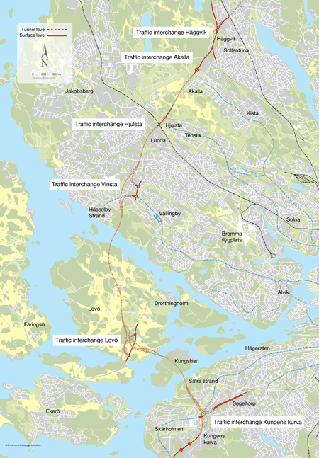
Route of The Stockholm bypass
Customer Service Monday to Friday 8 a.m. to 4 p.m.For traffic information and issues that requires immediate attention, we are open all hours.
Tel: +46 (0)771 921 921
Map showing The Stockholm bypass - a new road-link west of Stockholm.
Route of The Stockholm bypass
The red line shows where The Stockholm bypass is above surface. The dotted red line shows where ít´s below ground. The Stockholm bypass is connected to the surface road network at six places.
Click here for a large version of the map (GIF file, 315 kB, opens a new window)
Click here for a high resolution version of the map (JPEG file, 4 MB, opens a new window)
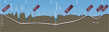
The tunnel in profile
Most of The Stockholm bypass is in tunnels - 18 out of 21 km. In the image below the tunnels connecting to the surface road network is not shown.
Click here for a large version of the image (JPEG file, 21 kB, opens a new window)
Click here for a high resolution version of the map (JPEG file, 1 MB, opens a new window)